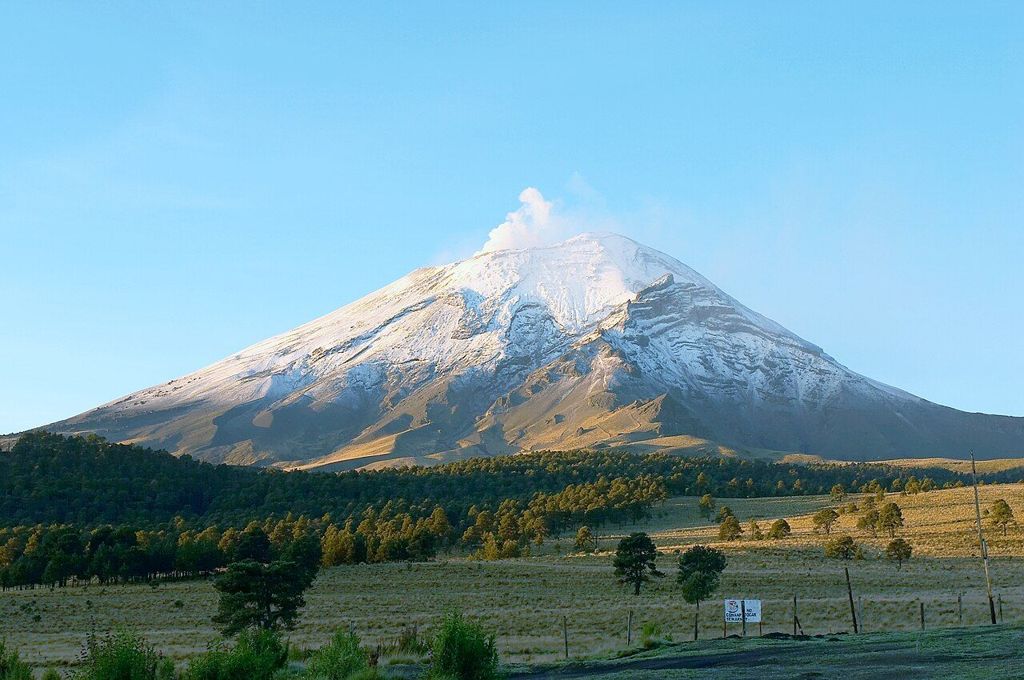
Lower and milder than Puebla, the flower-growing town of Atlixco sits under the volcano. Climb its hill on a clear morning and Popocatépetl fills the western sky.
- Best months: November to March, clear mornings
- Getting there: Bus or car south-west from Puebla
- Bring: Water, sun hat, light jacket, mask if ash falls
- Altitude: About 1,800 m: milder than Puebla, warm days, cool nights, summer afternoon storms.
Atlixco lies south-west of Puebla, lower down the slope of the valley and closer to the volcano. The drop in height makes a difference you can feel: days are warmer and softer, and the climate has long suited fruit trees and flowers. The town has built an identity around both, and it makes a gentle contrast with the stone and tile of the state capital. It is known across the state for its nurseries and flower fields, and for its view of Popocatépetl, which rises to the west, its snowy summit often trailing a thin plume of vapour.
A town of flowers
Flower growing is Atlixco's signature. Nurseries line the roads around the town, and the town's festivals use flowers on a large scale, with carpets of petals and floral displays in the main square at certain times of year. Late in the year the town is known for its displays of poinsettias, the flower called nochebuena in Mexico, which grows in the region. The exact dates and scale of festivals change, so check before you go if you are timing a visit around one.
The centre itself is small and walkable, with a main square, a parish church, arcades and several colonial churches and former convents in the streets nearby. Weekends bring visitors from Puebla, and the town is busiest then.
The nurseries are the easiest way to see the flower trade up close. Rows of potted plants, shrubs and seedlings stretch along the approach roads, and many growers sell to the public. Even if you buy nothing, a slow walk past the beds shows how much of the local economy rests on the mild climate and the volcanic soil.
The Cerro de San Miguel
Above the town rises the Cerro de San Miguel, a hill with a small chapel dedicated to Saint Michael at the top. Stairs and a path climb from the edge of the centre. The ascent is short but steep, and it can be tiring in the midday sun, so start early and take water.
From the top you look down over the town's roofs and church domes to the fields beyond, and, on a clear day, across to the volcano. The hill is also the setting for the town's best-known traditional festival, the Huey Atlixcáyotl, a celebration of the region's indigenous music and dance held in the autumn. Dates and arrangements change from year to year.
Popocatépetl, the smoking mountain
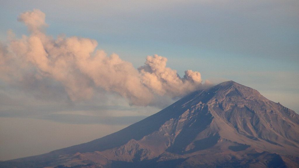
Popocatépetl is the second-highest peak in Mexico, at well over 5,000 metres, and one of the most active volcanoes in the country. Its name is usually translated as the smoking mountain. It reawakened in the mid-1990s after a long quiet period, and since then it has had phases of frequent activity, with gas and ash emissions, small explosions and, at times, glowing material thrown out near the crater.
Also in Puebla: Reading Puebla's Talavera façades
Beside it to the north lies Iztaccíhuatl, a long, quiet volcano whose ridge is often said to resemble a sleeping woman. Popocatépetl's steeper cone, with its plume, makes the pair easy to tell apart. Many old legends link the two mountains as lovers, and the story turns up in paintings and songs across central Mexico.
Understanding the alerts
Mexico's civil protection authorities monitor Popocatépetl closely and publish a colour-coded volcanic alert, often described as a traffic light, with green, yellow and red levels and steps within each. For some years the level has generally stayed in the yellow range, meaning the volcano is active and people should stay away from the crater area. The level can change quickly.
- Climbing to the crater has been forbidden for years, and a restricted zone surrounds the summit. Do not try to enter it.
- When activity increases, ash can fall on nearby towns, Atlixco and Puebla included, and airports in the region sometimes suspend flights for a time.
- If ash is falling, cover your nose and mouth, protect your eyes, close windows and avoid driving where visibility is poor.
- Check the current alert level and any travel advice before you go, and again on the day.
For most visitors the volcano is a view rather than a hazard. The point is to know where to look for updates and to respect closures.
Getting there and timing
Atlixco is roughly an hour from Puebla by road, depending on traffic. Buses run from the city, and the drive passes through farmland with the volcano ahead much of the way. Schedules shift with the season, so confirm them on the day.
The best views come early on clear mornings in the dry season, from about November to March, before haze builds and cloud settles over the summit. In the rainy months the mountain is often hidden by midday. A day trip that starts early in Puebla, climbs the hill in Atlixco in the cool of the morning and returns by late afternoon makes good use of the light.
Driving yourself gives the most freedom to stop for views, but roads near the volcano can be closed when activity rises, and fog or rain can cut visibility on higher stretches. Keep to main roads and follow any official signs.
Pairing Atlixco with the region
Atlixco works well as part of a few days around Puebla. A morning in the city's old centre, a half day at the pyramid of Cholula with its own view of the volcanoes, and a day in Atlixco give you the colonial city, the older sacred site and the mountain that watches over both.
At this lower altitude the sun is still strong, so a hat and sunscreen matter even when the air feels mild. Evenings cool quickly once the light goes.